


MONROE TWP Voting District, Fremont County, Iowa
About
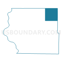
Outline

Summary
| Unique Area Identifier | 582161 |
| Name | MONROE TWP Voting District |
| County | Fremont County |
| State | Iowa |
| Area (square miles) | 35.92 |
| Land Area (square miles) | 35.92 |
| Water Area (square miles) | 0.00 |
| % of Land Area | 100.00 |
| % of Water Area | 0.00 |
| Latitude of the Internal Point | 40.85818040 |
| Longtitude of the Internal Point | -95.44196920 |
Maps


Graphs
Select a template below for downloading or customizing gragh for MONROE TWP Voting District, Fremont County, Iowa


Neighbors
Neighoring Voting District (by Name) Neighboring Voting District on the Map
- DEER CREEK TWP Voting District, Mills County, IA
- GRANT TWP PART W/O SHENANDOAH Voting District, Page County, IA
- PIERCE TWP Voting District, Page County, IA
- PRAIRIE TWP Voting District, Fremont County, IA
- RIVERSIDE TWP Voting District, Fremont County, IA
- WALNUT TWP Voting District, Fremont County, IA
- WEST TWP Voting District, Montgomery County, IA
- WHITE CLOUD TWP Voting District, Mills County, IA
Top 10 Neighboring County Subdivision (by Population) Neighboring County Subdivision on the Map
- Grant township, Page County, IA (5,577)
- Pierce township, Page County, IA (999)
- Riverside township, Fremont County, IA (313)
- Monroe township, Fremont County, IA (230)
- Deer Creek township, Mills County, IA (182)
- West township, Montgomery County, IA (172)
- White Cloud township, Mills County, IA (168)
- Walnut township, Fremont County, IA (145)
- Prairie township, Fremont County, IA (115)
Top 10 Neighboring Place (by Population) Neighboring Place on the Map
Top 10 Neighboring Unified School District (by Population) Neighboring Unified School District on the Map
- Red Oak Community School District, IA (7,118)
- Shenandoah Community School District, IA (6,281)
- Fremont-Mills Community School District, IA (2,432)
- Farragut Community School District, IA (1,445)
- Essex Community School District, IA (1,340)
- Nishna Valley Community School District, IA (1,334)
Top 10 Neighboring State Legislative District Lower Chamber (by Population) Neighboring State Legislative District Lower Chamber on the Map
Top 10 Neighboring State Legislative District Upper Chamber (by Population) Neighboring State Legislative District Upper Chamber on the Map
Top 10 Neighboring 111th Congressional District (by Population) Neighboring 111th Congressional District on the Map
Top 10 Neighboring Census Tract (by Population) Neighboring Census Tract on the Map
- Census Tract 401, Mills County, IA (3,023)
- Census Tract 9604, Montgomery County, IA (2,902)
- Census Tract 4901, Page County, IA (2,624)
- Census Tract 9701, Fremont County, IA (2,085)